
Allegheny County ZIP Codes by Layer
Allegheny County's official ZIP-boundary layer returned 127 features when reviewed. Each feature carries a ZIP, a postal-city NAME, and a ZIPTYPE. The table keeps the full list compact by grouping repeated layer values, while preserving every ZIP and postal name reported by the source. “Post Office” below means the layer's postal name. It does not identify a municipal government, a city limit, or a specific post-office counter.
| ZIP Code | Areas Covered | Post Office | Notes |
|---|---|---|---|
| 15003 Ambridge; 15005 Baden; 15006 Bairdford; 15007 Bakerstown; 15012 Belle Vernon; 15014 Brackenridge; 15015 Bradford Woods; 15017 Bridgeville; 15018 Buena Vista; 15020 Bunola; 15024 Cheswick; 15025 Clairton; 15026 Clinton; 15028 Coulters; 15030 Creighton; 15031 Cuddy; 15032 Curtisville; 15034 Dravosburg; 15035 East McKeesport; 15037 Elizabeth; 15044 Gibsonia; 15045 Glassport; 15046 Crescent; 15047 Greenock; 15049 Harwick; 15051 Indianola; 15056 Leetsdale; 15057 McDonald; 15063 Monongahela; 15064 Morgan; 15065 Natrona Heights; 15068 New Kensington; 15071 Oakdale; 15075 Rural Ridge; 15076 Russellton; 15082 Sturgeon; 15083 Sutersville; 15084 Tarentum; 15085 Trafford; 15086 Warrendale; 15088 West Elizabeth; 15089 West Newton; 15090 Wexford | Layer postal areas listed in the first column | Each listed postal name | Non-unique except 15006, 15020, 15028, 15032, 15047, 15075, and 15082, which are PO Box ZIPs. |
| 15101 Allison Park; 15102 Bethel Park; 15104 Braddock; 15106 Carnegie; 15108 Coraopolis; 15110 Duquesne; 15112 East Pittsburgh; 15116 Glenshaw; 15120 Homestead; 15122 West Mifflin; 15126 Imperial; 15127 Ingomar; 15129 South Park; 15131 McKeesport; 15132 McKeesport; 15133 McKeesport; 15135 McKeesport; 15136 McKees Rocks; 15137 North Versailles; 15139 Oakmont; 15140 Pitcairn; 15142 Presto; 15143 Sewickley; 15144 Springdale; 15145 Turtle Creek; 15146 Monroeville; 15147 Verona; 15148 Wilmerding | Layer postal areas listed in the first column | Each listed postal name | Non-unique except 15127 Ingomar, a PO Box ZIP. |
| 15201-15229 Pittsburgh | Pittsburgh postal area | Pittsburgh | Each code in this sequence is non-unique. 15230 is not included in the County layer's listed Pittsburgh sequence. |
| 15231 Pittsburgh; 15232-15239 Pittsburgh; 15241 Pittsburgh; 15243 Pittsburgh; 15260 Pittsburgh; 15261 Pittsburgh; 15275 Pittsburgh; 15276 Pittsburgh; 15282 Pittsburgh; 15289 Pittsburgh; 15290 Pittsburgh | Pittsburgh postal areas | Pittsburgh | 15231, 15260, 15261, 15275, 15276, 15282, 15289, and 15290 are unique. 15232-15239, 15241, and 15243 are non-unique. |
| 15321 Cecil; 15332 Finleyville; 15642 Irwin; 15668 Murrysville; 16046 Mars; 16056 Saxonburg; 16059 Valencia; 16066 Cranberry; 16229 Freeport | Postal territories that touch or serve part of the County | Each listed postal name | All are non-unique. A layer postal name may point outside current county lines. |
The repeated Pittsburgh entries do not create a single citywide postal boundary. The layer lists every code from 15201 through 15229 individually, then lists additional Pittsburgh labels and ZIP types separately. Likewise, Ambridge, Baden, Cecil, Finleyville, Irwin, Murrysville, and several Butler, Westmoreland, or Armstrong-area names can appear because postal and county geography overlap at their edges.
Allegheny County's ZIP-boundary GIS layer is the source shown here.
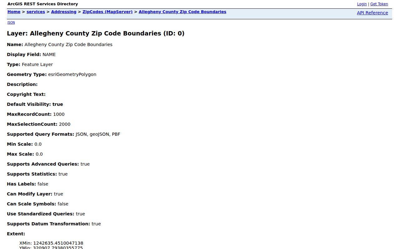
The layer is valuable for checking the County's published postal geometry and types. A delivery ZIP still needs address-level confirmation through USPS before it is used for mail or location verification.
Allegheny County ZIP Code Geography
A postal NAME is a delivery label, not a municipal boundary. Many of the layer's non-unique codes cross borough, township, city, county, or postal-service boundaries. The fact that an address uses “Pittsburgh” or a 152xx ZIP does not establish that it falls inside Pittsburgh city limits. The same point applies to a postal label that names Ambridge, Baden, Cecil, Finleyville, Irwin, Murrysville, Mars, Cranberry, or Freeport.
For geographic research, pair the ZIP with the municipality and a parcel or address point. The County layer supplies postal context. A local municipal record identifies local jurisdiction. A parcel or legal description connects property records to land, and USPS validates delivery. These are different facts, and they should stay separate in notes and search forms.
Allegheny County ZIP Address Assignment
Local cities, boroughs, and townships assign or correct addresses. Allegheny County maintains and consolidates the central address data, updates it daily, supports departments such as 911 and Property Assessments, and synchronizes the data with the Postal Service. USPS does not assign a new address. For a subdivision or address change, the documented path runs from the municipality to the County and then to the Postal Service.
County standards call for numeric order, odd and even sides of a street, spelled-out street names in 911 data, and no duplicate street names within a municipality or ZIP where possible. An address is assigned to a building rather than to a parcel, so one assessment parcel can carry more than one address. That is why postal mapping can narrow geography without replacing local address authority.
Note: Ask the municipality about a new or corrected address, then use County data and USPS to confirm its mapped and delivery forms.
County ZIP Code Geocoder Fields
The County AddressPoints geocoder is ZIP-aware, but it is an address-matching tool rather than a way to return every parcel in a ZIP. It accepts these optional fields. Use the most complete known address, then inspect the result against the postal and municipal details.
| Field | Use |
|---|---|
| Street | Street portion of a known address. |
| City | Postal or locality text supplied with the address. |
| State | State portion of the address. |
| ZIP | Optional postal code used for matching. |
| County | Optional county field that helps localize a matching request. |
| Full Address | One field for the complete address when separate fields are not used. |
The County AddressPoints geocoder can confirm a match for a known address. It cannot provide an all-resident or all-parcel list for a postal area. Keep the result with its date because address data is maintained and synchronized over time.
Finding Allegheny County Residents by ZIP
A ZIP-based search should begin with a person or address already known, not with a claim that a ZIP produces a household list. First confirm delivery geography. Then use the County layer and geocoder to identify the relevant postal area. The County Real Estate Portal does not have a ZIP filter in its inspected public form. It searches by address, parcel, or municipality, so a ZIP must be translated into a more specific address or parcel search.
- Verify the known street address and delivery ZIP with USPS before treating a postal label as current.
- Review the County ZIP layer to see the reported postal name and ZIP type, and record the municipality separately.
- Use the AddressPoints geocoder with a street, city, state, ZIP, county, or full-address field to test the address match.
- Use the County Real Estate Portal with the address, parcel number, or municipality to inspect an individual property record, not a ZIP-wide result.
- Use Pennsylvania's voter-status tool only for its stated self-status and polling-place purpose. It is not a public browse-by-ZIP resident list.
Once the search has narrowed to a specific address or street, the Allegheny County street directory provides the address-keyed record workflow. This postal-geography workflow does not recreate that street-level trail.
USPS ZIP Code Delivery Checks
USPS offers three relevant modes: By Address, By City/State, and Cities by ZIP. By Address accepts Company, Street Address, Apt/Suite/Other, City, State, and ZIP. By City/State accepts City and State. Cities by ZIP accepts a ZIP. These modes can validate delivery geography and a postal city after County mapping, but USPS cautions that a ZIP result does not confirm a particular person or company at an address.
USPS ZIP Code Lookup is the source shown here.
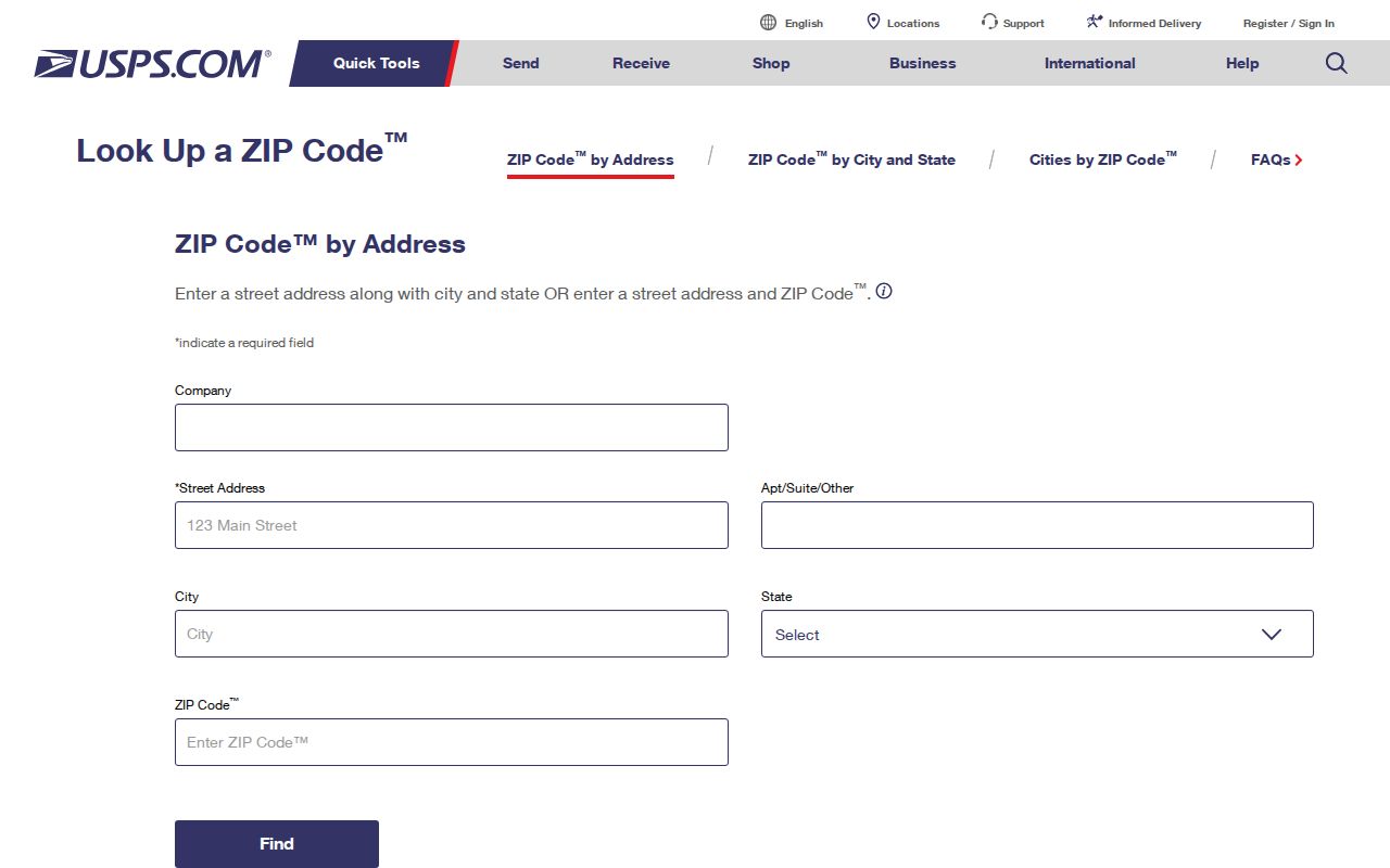
Use the USPS result to check delivery formatting, then retain the County ZIP layer and municipality as separate geographic references. The tools answer related but different questions.
Note: A delivery ZIP validates mail routing, not a person's identity, residence, or municipal jurisdiction.
Allegheny ZIP Code Boundaries and City Limits
ZIP boundaries and city limits disagree in ordinary, documented ways across Allegheny County. Non-unique ZIPs can span multiple municipalities or county lines. A PO Box or unique ZIP may not represent a neighborhood at all. Pittsburgh's postal label appears across many codes, yet the County layer itself includes postal territories whose names point beyond the County. Delivery verification plus municipality and parcel evidence is the safe way to establish geography.
- ZIP and ZIP+4
- A ZIP identifies a delivery area. ZIP+4 adds a more specific delivery segment for sorting and routing; it does not replace an address.
- PO Box ZIP
- A postal code for box service, such as Bairdford, Bunola, Coulters, Curtisville, Greenock, Rural Ridge, Sturgeon, or Ingomar in the County layer. It is not a mapped neighborhood claim.
- Unique ZIP
- A code assigned for a single organization or special postal use. The layer marks 15231, 15260, 15261, 15275, 15276, 15282, 15289, and 15290 as unique.
- Carrier route
- A mail-delivery grouping used within postal operations. It can aid routing but is not a municipal boundary or a list of people.
Allegheny County Postal Labels After 1907
Postal geography also has a historical-name problem. Allegheny City remained separate until Pittsburgh annexed it in 1907 and is now associated with the North Side. Historic records may use Allegheny City, Pittsburgh, Homestead, a named borough, or a later postal name for places that a current map describes differently. A postal label should therefore be paired with the date and municipality before it is used to choose an archive or historical directory.
The 1907 Allegheny City Hopkins plat book offers a bridge between historic and current North Side geography. It names North Shore, Manchester, Chateau, Allegheny Center, East Allegheny, Troy Hill, and Washington's Landing in its collection context. It is a historic map source, not a current delivery authority.
Allegheny County ZIP Search Limits
Neither the County layer, the geocoder, the assessment portal, nor USPS offers a countywide resident roster by ZIP. The assessment portal's address, parcel, and municipality fields can help locate an individual property record, but the portal does not carry a ZIP search field. A property result can identify assessed ownership and address fields, yet it does not establish present occupancy. A postal validation result likewise concerns mail delivery, not residency.
Some address information may be protected or substituted. Pennsylvania's Address Confidentiality Program gives eligible participants a substitute mailing address and protects actual address information under its governing rules. Do not use another index to defeat an address protection. For a disputed mapped or address record, contact the municipal or County custodian that maintains that particular field.